



It was on Jan. 7, 2024, that I verified Israel’s drone strike on the car driven by Hamza al-Dahdouh, the Palestinian journalist and son of Al Jazeera’s Bureau Chief Wael al-Dahdouh, alongside his colleagues Mustafa Thuraya, Qusai Salem and Hazem Rajab. It was one of the many violent acts that I had geolocated since the start of Israel’s genocidal response to the Hamas-led attacks of Oct. 7, 2023. It was also the moment I met Ahed. He sent me a direct message on X asking how I had managed to find the precise location where the Palestinian journalists had been killed when several media outlets had gotten it wrong.
“Can I ask if you have ever been to Rafah, or in Gaza?” he asked.
“No, I haven’t been,” I answered, before continuing: “It had always been my intention though, before all of this happened.”
Ahed’s response showed both surprise and fascination. “I find it amazing that somebody living thousands of kilometers away from where I am has managed to know Gaza so very well as you.”
As time passed, Ahed and I stayed in touch. I learned that he was a young man studying hard to graduate from the faculty of medicine at the Islamic University in al-Mughraqa in the central Gaza Strip. Its campus is attached to the Turkish-Palestinian Friendship Hospital, the only hospital in Gaza dedicated to treating cancer patients. During his studies, Ahed made the hour-long journey back and forth between Rafah and medical school every day.
“Us Rafah students were all grouped up just because we all eventually have to go back home for a considerable duration of what’s left of our day,” he wrote to me. “We would go separately on our own with the buses that go to the Islamic/Azhar Universities. They make a stop at Al-Mughraqa and we would take an additional ride or walk to the medical school. And then on the way home there’s barely any cars that go to Rafah, so either 5-6 of us agree with a specific driver or wait for the already crowded bus at the Al-Rashid Coastal Road.”
The war continued, and so did my regular conversations with Ahed. As Israel blocked foreign press from independently accessing the besieged and occupied strip, open-source intelligence proved to be one of the few ways, second to the courageous Palestinian journalists risking their own lives on the ground, to closely examine what was happening in Gaza from outside, often nearly in real time.
Ahed used to live in al-Jneina, a lively neighborhood in eastern Rafah. His family was originally from Aqir, an agricultural village on the coastal plain near Ramla whose Palestinian inhabitants were displaced in 1948. Al-Jneina housed the Rafah Municipality Stadium, the Al-Istiqama and Al-Ihsan mosques, several schools and the Eastern Cemetery, the largest cemetery in the Rafah Governorate. The neighborhood also sat along a commercial route used by trucks arriving from the Kerem Shalom border crossing, which would cross Salah al-Din Road and pass through al-Bayuk into eastern Rafah. Its streets were filled with shops catering to the needs of its large population.
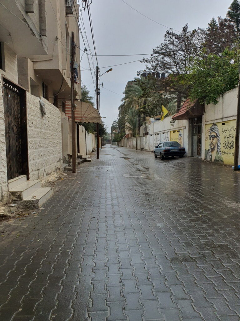
There was considerable cultural diversity in al-Jneina. The neighborhood brought together urban residents, others from agricultural and village communities, and Bedouins; it was a mixture of the urban and rural. Apartment buildings and residential towers stood alongside a way of life that remained connected to the agricultural land on the neighborhood’s eastern and northern edges. Here, several strands of Palestinian life in southern Gaza met.
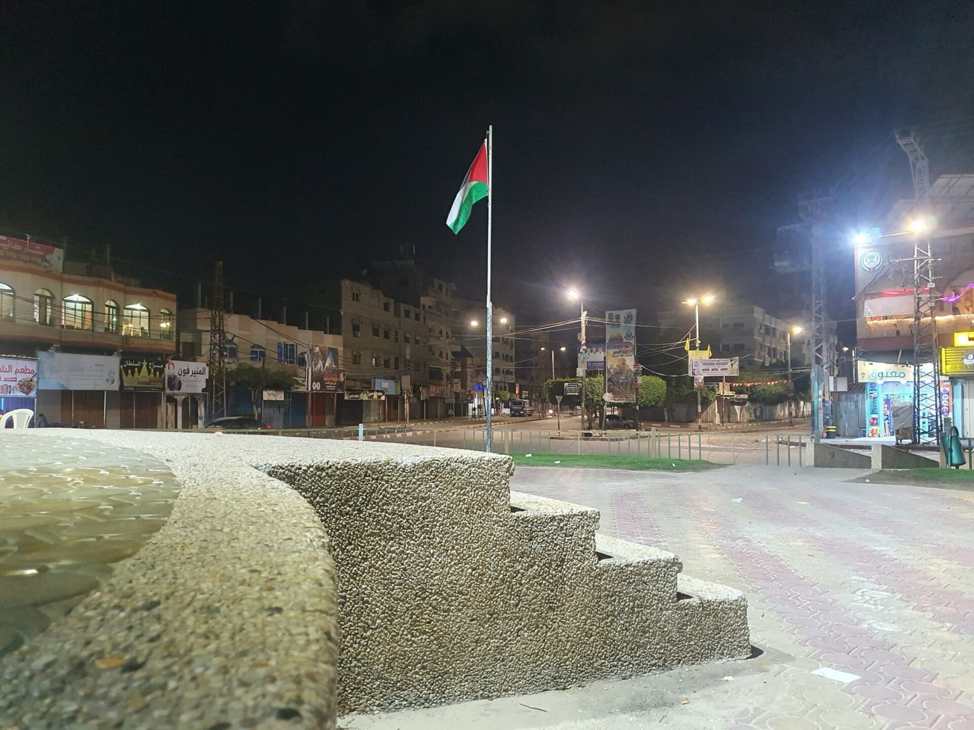
There are places outside al-Jneina that Ahed still misses, even though there was nothing particularly remarkable about them. “I still miss Al-Awda roundabout,” he told me. When I asked him why, he said it was the “busyness it had,” and the fact that he would see it on almost every errand he made. “That and Al-Nijma,” he added. “On the way to school, to the private tutor, back from medical school, on the way shopping.”
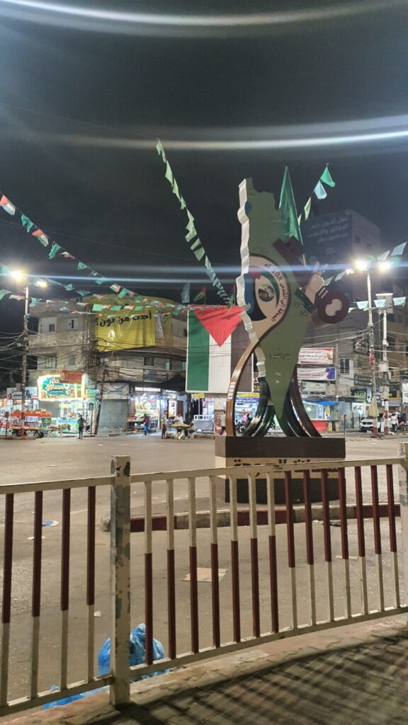
The two roundabouts were fixtures in the everyday geography of Rafah. Al-Awda sat at one of the city’s important crossroads, where routes from different parts of Rafah converged. One road stretched from the Mediterranean coast in the west, through Tel al-Sultan and the camp market before reaching al-Awda and continuing east; another came south through Khirbet al-Adas and Shaboura refugee camp, passed through al-Awda and continued toward the market and the Egyptian border. Al-Nijma, nearby, was another busy landmark around Shaboura and Rafah’s commercial center, surrounded by shops and other businesses.
They were not destinations. They were simply places Ahed passed so often that he hardly had reason to think about them.
Other parts of Rafah Ahed remembered less as routes than as places where he could simply spend time. He missed the days and nights when he had gone to the beach with his family or friends. When I asked what he liked doing there, his answer was simple: “Swimming, lots of swimming.”
The Mediterranean has long been one of the few readily accessible places of leisure for Palestinians living in Gaza. Before the war, families crowded the coastline during the hot summer months, particularly in the evenings. People came to swim, walk, exercise or sit together along the shore, while cafes and simple cafeterias offered somewhere to spend the evening overlooking the sea. During Ramadan, families would bring food and break their fast together beside the water. Palestinians frequently described the sea as a “mutanaffas” — a breathing space, or outlet — from the pressures of everyday life in the besieged strip.
Rafah’s coastline had a history of its own. At its southwestern edge, near the Egyptian border, stood the Swedish Village, a small community whose inhabitants included Palestinian refugees displaced in 1948 during the Nakba from places such as Hammama, Isdud, al-Jura and Barbara. Many came from families for whom fishing had long been a livelihood. After years of living in tents and mud houses, new homes were built there with Swedish assistance in 1965, giving the village the name by which it became known. Around it stretched the coastal landscape of Rafah, where fishing and agriculture existed alongside the beaches to which residents of the city came for recreation.
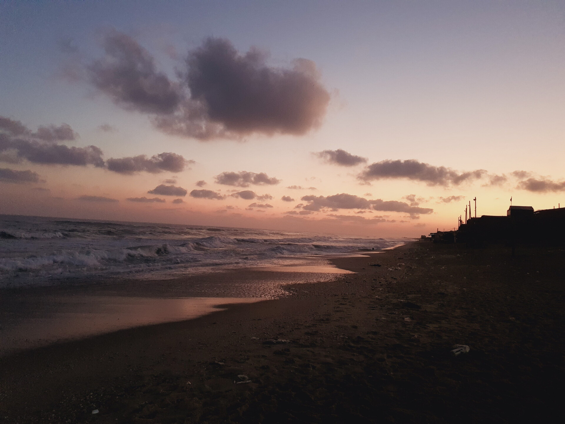
In the months before October 2023, Ahed and his friends would sometimes stay up all night at a cafe by the beach. At other times, he would walk along the shore, either alone or with a friend. One photograph he took in June 2022 shows an almost empty beach in the early morning. Waves roll toward the darkening sand while the sky above the Mediterranean fades from pink and orange into purple, with the silhouettes of buildings lining the shore in the distance.
The beach was also tied to friendships Ahed found himself remembering during the war. “I also miss the high school days,” he told me. “I had met the most wonderful people during those days, some even became medical colleagues.” Some remained his friends years later.
Former U.S. President Joe Biden had previously told Israel’s Prime Minister Benjamin Netanyahu that Israel should not launch a military operation in Rafah “without a credible and executable plan for ensuring the safety of and support for the more than one million people sheltering there.” It was widely seen as a “red line” for the Biden administration, but reality quickly proved otherwise. On May 6, 2024, the Israeli military announced the evacuation of eastern neighborhoods of Rafah through leaflets, as well as social media posts published by its spokespeople.
“When that evacuation order was issued,” Ahed said, “we immediately went on to start evacuating whatever we could. Even if our block wasn’t issued a warning, we knew it was a lost cause regardless and that they will invade all of Rafah.”
This proved to be true, as Israeli military vehicles and positions were visible the following day on satellite imagery in areas including al-Bayuk, Shokat as-Sufi and the Rafah border crossing.
“We slept through the sound of artillery, bombardments and gunfire that night and left the next morning.”
Ahed had started following open-source investigators on X, including me, and began paying closer attention to what we shared. He also learned how to use the Copernicus Browser, a website providing access to freely available, lower-resolution satellite imagery.
“I would check in every week, for me and my friends, of whom I had seen their homes lost as well.”
Ahed wasn’t the only one for whom this became one of the last ways to see home. In the past couple of years, I began to receive a particular kind of message from Palestinians who, like Ahed, had found my work online: “Could you look and see if my house is still standing?”
I would read these messages with a feeling of discomfort, one that made everything I was looking at suddenly feel much closer. I had spent years investigating Gaza and the West Bank, but being contacted personally by someone who could no longer reach their home felt different.
I would sit with the message for a while and think about how to approach it. There was something perverse about the situation: The home belonged to the person messaging me, but they could not access it, return to it or even see it for themselves. Instead, they were forced to ask a man sitting behind his laptop in Europe to tell them whether their house was still standing. But I would decide to answer. I would ask them several questions in order to locate the house and neighborhood as precisely as possible and give them as honest an answer as I could. Looking through the different dates available to me, I would eventually see the answer before my eyes and then return to the conversation.
More often than not, I would have to say, “I’m sorry.”
Their responses would often be very emotional. I would hear about how they had built a floor above their parents’ home, part of a familial building style common across historic Palestine. One person told me about a house that had taken great effort to build and in which he and his wife, together with their child, had only recently started living before all of this happened. Now it is gone. At the same time, they would tell me that at least now they knew.
The same images meant something very different to the people messaging me. For me, they were evidence. For them, they could be the only recent image of a house they had lived in, a field they had cultivated or a neighborhood they could no longer reach. It felt deeply unfair that, sitting thousands of miles away, I could see a more recent image of their homes than they could.
Rafah continued to face a ground invasion, heavy bombardment and widespread demolitions by the Israeli military. “Since we couldn’t see the scale of things for ourselves, we still held onto the hope that hopefully nothing too bad had happened,” Ahed told me.
For Ahed, the knowledge he had gained about the capabilities of open-source intelligence and its tools started to become what he described to me as “sort of like a curse.”
“I went on to see the latest satellite imagery on the night of 5 December 2024,” he told me. “And then I saw what I never wanted to see. Widespread destruction had taken place around the block where I used to live, like if somebody had used Photoshop and made my area totally gray.”
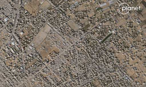
Israel’s bombardment had destroyed his aunt’s building and another building near his grandparents’ house.
“I remember holding my tears and trying not to alert my family that something was wrong. I had only messaged my uncle who had left Gaza just out of the need to tell at least somebody about what had happened.”
Over the following days, Ahed tried his best not to tell the rest of his family. They continued to hold on to a hope that he himself no longer had. Eventually, he could not keep what he had seen from them anymore.
“I told them what I had seen,” he said, “and we all cried.”
In a way, Ahed had now found himself in a position similar to the one I had repeatedly experienced with Palestinians who had messaged me. He could see something about his family’s home that they could not. And once he knew, he had to decide how and when to tell them.
For Hamzé Attar, Rafah meant his grandmother. Attar, a Luxembourg-based defense analyst who grew up in Gaza, spent most of his life in Gaza City, but his childhood summers were in Rafah. His grandparents lived in Yibna refugee camp. He remembered playing football beside the border with Egypt, visiting his grandmother every Friday and walking from the camp toward the beach. “Rafah was my grandmother,” he told me. There was the smell of freshly baked bread, the olive and lemon trees around her home, and her stories about Yibna, the Palestinian village from which his family had been displaced in 1948. On the wall hung the keys to their old house.
As Israeli forces advanced through Rafah, Attar began checking satellite imagery to see how close they came to his grandparents’ house. “Every day, I see they are approaching,” he recalled. Then came a period of a week or two when he could not obtain new imagery. When imagery became available again, he saw an Israeli bulldozer in the heart of Yibna. “It broke my heart at so many levels.”
Looking at Gaza from above could itself feel like another form of displacement. “You look at the satellite images, and you feel displaced again. You feel like a refugee again,” Attar said. “My school is gone. Our house is gone. My grandparents’ house is gone. The houses of our relatives are gone. The streets that I loved are gone. The places where I used to hang out are gone.”
Sometimes, he would try to show his wife somewhere he used to spend time, only to find there was little or nothing recognizable left. Someone without that connection to Gaza could still see the destruction and understand something of the pain, he told me. But what was harder to see was something deeply personal, the feeling that “someone has erased your memories from a place.”
Satellite imagery did not only allow us to see what had been destroyed. For those of us watching from outside Gaza, it made it possible to watch that destruction accumulate over time, building by building and neighborhood by neighborhood. Open-source intelligence usually requires a degree of analytical distance from the material we examine. Gaza has repeatedly collapsed that distance for me.
A fellow open-source investigator who has worked extensively on geolocating images and videos coming from Gaza, and who works under the pseudonym Anno Nemo (their real identity is known to New Lines), told me that they had also received messages similar to the ones I described from Palestinians in Gaza.
“I often didn’t know right away how to respond; I wanted to apologize or express that I was trying to understand their pain, but that’s difficult when you know everything they’ve been through,” they told me. “I also wasn’t always sure whether I should ask them about their experiences or if it would be better to keep quiet about it.
“It felt wrong that they wanted, or felt they had to, ask me, a stranger using a pseudonym on X, such a personal and important question. I try to imagine it the other way around, if I had to, but that’s very difficult and feels completely unfair.
“There’s not much I can do about it, and of course I’d love to help those people, but at the same time, that kind of ‘power’, the ‘power’ to tell someone else of the fate of their home, felt completely wrong.”
There is a risk, I believe, of open-source investigators unintentionally contributing to erasure or dehumanization. Images do not only show what is present; they can also obscure what has been made absent. When analyzing visual content or satellite imagery from afar, it becomes possible to process what we see solely as data: a landscape in which changes happen, buildings disappear and new roads emerge. The danger is not necessarily that the image is inaccurate. It is that the landscape produced by destruction begins to appear natural once the people, histories and ways of life that preceded it have disappeared from the frame.
A destroyed building can become difficult to see as somebody’s home. Agricultural land important to local food production can become a flattened landscape, replaced by military roads, corridors and outposts. What remains visible is destruction and death, while the life that preceded it becomes harder to recover. There is a danger, then, that the occupying power responsible for changing the landscape also comes to dominate the image through which that landscape is remembered.
Ahed sometimes reminded me how much could disappear inside an image. When he traveled from Rafah to medical school in al-Mughraqa, he remembered walking through what he simply called “the nice fields.”
Al-Mughraqa was a predominantly rural community south of Gaza City. Agriculture was not incidental to the landscape: Nearly two-thirds of its land was agricultural, with residents cultivating citrus trees, seasonal vegetables and legumes. The village’s name itself was tied to the land and water around it, derived from the rainwater that historically collected there because of its proximity to Wadi Gaza and sometimes flooded the area. Archaeologists working there around the turn of the century described a landscape where agricultural fields met sand dunes, while beneath them lay evidence of human settlement dating back thousands of years.
Beside al-Mughraqa was al-Zahra, a much younger city established in 1998 as Gaza expanded southward. Over the following decades, the area became home to a concentration of higher education institutions. The University of Palestine established itself in al-Zahra, as did Al-Israa University, while university facilities in and around al-Mughraqa brought thousands of students into the area. Among them was Ahed, making his daily journey north from Rafah to study medicine.
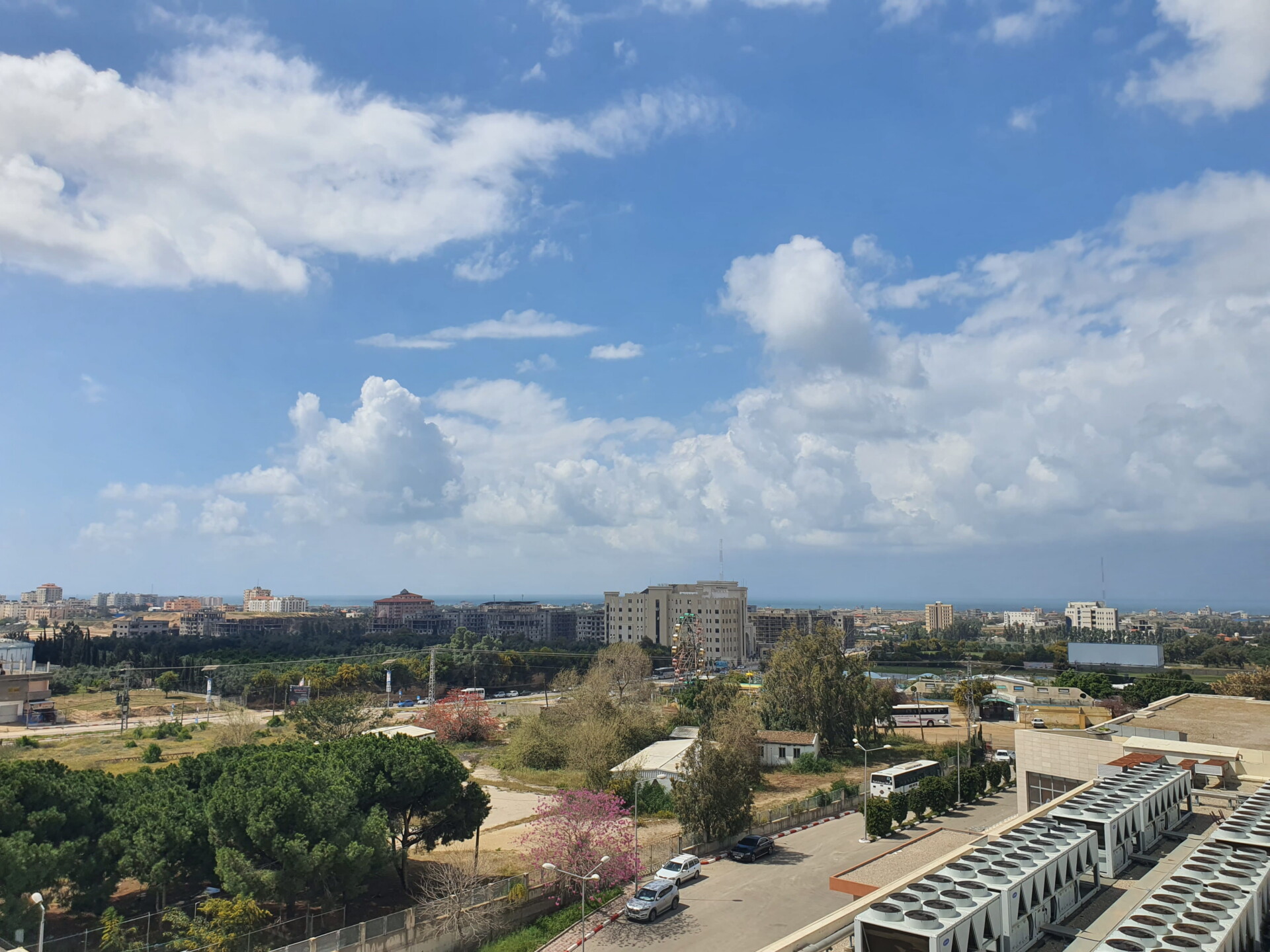
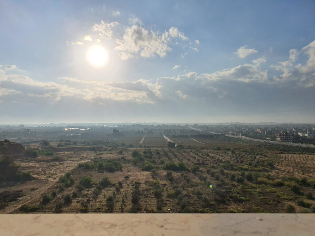
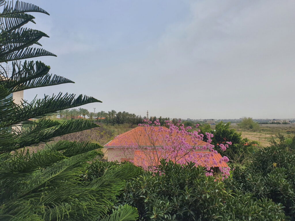
From the faculty of medicine, Ahed could look east across cultivated fields and rows of trees toward Salah al-Din Road and farther toward Juhor ad-Dik. Students traveled through this agricultural landscape on their way to class. People grew vegetables and citrus there. Sometimes Ahed walked through the fields because he simply enjoyed doing so. In a photograph he took in December 2022, dirt tracks run between the fields and scattered buildings rise among the trees.
Juhor ad-Dik itself was an agricultural village, with fertile land used to grow vegetables, olives and citrus. Ghayda, another friend of mine from Gaza, shared photographs of her father’s farm there. Her family was displaced in 1948 from Jaffa, a city long associated with the citrus groves that surrounded it and the famous Jaffa oranges exported through its port.
Her father had started with a small piece of land and expanded it little by little over the years. As children, Ghayda and her siblings had dreamed of having a house with a swimming pool, and eventually their father built one there. Around it grew olive, clementine and almond trees. He taught himself to keep bees and began producing his own honey.
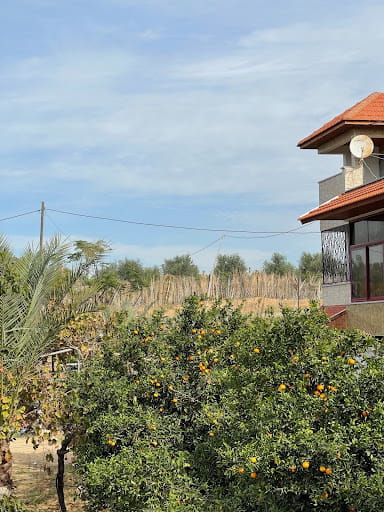
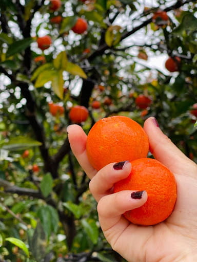
Almost every Friday, the family would go there together. “Friday was our sacred day, family day,” Ghayda told me. They walked around checking the trees, gathered for barbecues and spent much of the summer there. She especially remembered the almond trees flowering in spring. Photographs she shared with me show their white blossoms against a blue sky, citrus trees heavy with fruit and a ginger cat wandering beneath them. “It used to be really our favorite spot on earth,” she said.
Her father was not someone she remembered becoming particularly attached to things, but the farm was different. “It’s like his baby project,” she said. He had built it almost from the first stone.
The farm is now, in her words, “flattened and inaccessible.” “It still feels like the dream of our life that came true but then was taken away,” she later told me, “as if you only dreamed of having it come true rather than living it in reality.”
This was not the first time Israel had sought to divide Gaza through its geography. In the early 1970s, Ariel Sharon, then head of Israel’s Southern Command, promoted what became known as the “Five Fingers” plan: Israeli-controlled wedges extending into the Gaza Strip to separate Palestinian population centers and control strategic routes and territory. One of the settlements established as part of this broader effort was Netzarim, built in 1972 on land expropriated from the Abu Madyan Bedouin community near al-Mughraqa. Al-Zahra itself was later established partly in response to the settlement’s expansion.
Israel dismantled Netzarim in 2005. Nearly two decades later, the name returned.
During the current war, the Israeli military established the Netzarim Corridor across central Gaza. Fields, homes and other structures around al-Mughraqa and al-Zahra were cleared as military roads appeared in their place.
Soldiers and officers told Haaretz that an engineering operation led by Col. Golan Vach demolished buildings across the area. One soldier described the purpose of the operation as flattening as much of Gaza as possible, as quickly as possible. The Israeli military rejected allegations of wrongdoing, saying that Vach’s decisions were professional and made in cooperation with senior command.
Seen from a satellite, the consequences are easy to follow. Fields disappear. Buildings vanish. Roads widen across what had been neighborhoods and agricultural land. What the satellite cannot tell us is that Ahed liked walking through those fields, or that Ghayda’s father grew clementines and oranges there.
On Dec. 7, 2023, Yinon Magal, an Israeli television presenter and prominent supporter of Netanyahu, posted a video on X showing the destruction at Al-Azhar University’s campus in al-Mughraqa. Magal, who hosts the popular nightly program “The Patriots” on Israel’s right-wing Channel 14, would later tell The New Yorker that he viewed his role as helping Netanyahu and his political camp “win.”
“A Hanukkah gift from Division 36,” Magal wrote above the video, referring to the 36th “Ga’ash” Division, a regular-service division of the Israeli military. “The university that was established on the ruins of Netzarim. May its memory be a blessing.”
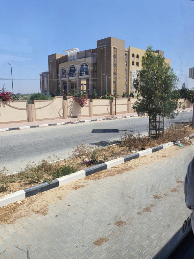
The video shows buildings standing in the distance before a series of explosions tear through them, sending clouds of dust and smoke into the air. Among the university buildings destroyed in al-Mughraqa was its faculty of arts and humanities — the same building Ahed had photographed in September 2021 while driving past it on his way through the area. In his photograph, the faculty stands beside a quiet paved road, its arched windows overlooking trees and flowering plants growing along the university wall.
The faculty had existed since the early years of Al-Azhar University in the 1990s, teaching subjects including Arabic and English literature, history, geography, sociology, political science and media. Its move to a purpose-built campus in al-Mughraqa had once been described by its dean as a dream nearing reality.
The university was described not through the Palestinian students who studied there, the academics who taught there or the institution that had been built over decades, but through an Israeli settlement that had once stood nearby: Netzarim.
The contrast was the same one I had begun noticing while looking at Gaza from above. Ahed remembered this landscape through his daily journey to medical school. Magal presented the destruction of that landscape as a “gift,” while invoking the Israeli settlement that had preceded it.
The destruction also reached the place Ahed had traveled to every day from Rafah. Beside the fields he remembered walking through stood the faculty of medicine of the Islamic University of Gaza and the adjoining Turkish-Palestinian Friendship Hospital. Ahed had spent his first three years studying the basic sciences in the main medical faculty building. He had started his fourth year only a month before the war began, moving into the clinical stage of his medical education. That brought him into lecture halls inside the hospital itself, used by students in their fourth through sixth years.
The hospital and medical faculty would eventually become part of the landscape of destruction around the Netzarim Corridor. On March 21, 2025, footage showed a series of large explosions at the Turkish-Palestinian Friendship Hospital, widely described at the time as its demolition. Yet a comparison of satellite imagery from March 18 and March 25 showed a more complicated picture: Much of the hospital complex remained standing, while its southern building had been struck and other structures showed apparent shell damage. On March 27, footage published from the area showed Israeli tanks shelling the hospital and several floors of the adjacent faculty of medicine.
From afar, I could establish which buildings had been struck, which remained standing, where shell damage appeared and when the landscape changed. What I could not recover from those images was what the buildings meant to Ahed. Only weeks before the war, he had begun his clinical years there, sitting in lecture halls inside the hospital after three years studying basic sciences. It was a place around which he had begun building his future.
When a ceasefire took effect in January 2025, Ahed was finally able to return to Rafah and see for himself what, until then, he had largely been seeing through satellite imagery.
“We went back to Rafah to see for ourselves what had happened,” he told me, “and it really changed my definition of what ‘destruction’ looks like.”
By then, Ahed already knew from satellite imagery that widespread destruction had reached the block where he had lived. But knowing that from an image and walking through what remained of his city were different things. His grandparents’ house was still standing, and his family held on to the hope that they might eventually be able to live there once conditions became somewhat habitable again. Around it, however, Ahed remembered an area that “really lacked any sort of life.”
They went through what remained of the home where they had been living since their displacement, salvaging whatever they could and taking it either with them or to his grandparents’ house.
The ceasefire did not last. When the war resumed in the following months, Ahed told me that his response to what was happening in Rafah had begun to change. He had developed what he called “a sort of apathy” toward what had happened there. His concern shifted toward the parts of Gaza that had not yet experienced the same scale of destruction. He hoped, he said, that they would never meet “a fate similar to ours.”
By then, he had largely given up hope of returning. “Since we had seen how Rafah was really erased from the map this time from the constant months of bombardments, I had lost hope of ever coming back,” he told me.
Eventually, the grandparents’ house that had survived their first return was gone too. It was the place where Ahed and his family had taken what they could salvage, and the place they had hoped they might one day be able to live. Yet when Ahed learned what had happened to it, his reaction was remarkably muted. He described it as “ever so slight and apathetic.”
“At least my loved ones and I are all well physically,” he told me. He could still hope for a “better future and cessation of further senseless wars and suffering.”
What happened to Rafah has made me think about how easily an altered landscape becomes accepted as the landscape itself. A military road appears where fields once stood. A neighborhood disappears. A new boundary acquires a name. Eventually maps begin to reproduce it, negotiations take it into account and people speak of it as though it had always been there. What would once have seemed extraordinary gradually becomes part of the geography everyone is expected to work around.
The Rafah that Ahed described to me — the crowded roundabouts, his journeys to university and nights spent with friends by the sea — was progressively destroyed until he could tell me that it had been “erased from the map.” Yet I have seen echoes of this process elsewhere. In southern Lebanon, satellite imagery and reporting have documented Israeli forces destroying homes and other civilian infrastructure, clearing agricultural land and leaving parts of villages increasingly difficult to inhabit or return to. The histories of Gaza and southern Lebanon are not the same, but I have found something unsettlingly familiar in watching places where people lived become landscapes from which those lives have been removed.
Before Rafah became associated with evacuation orders, Israeli control behind the “yellow line” and images of destruction, it was a place where ordinary life continued, despite years of blockade, occupation and war.
Tariq Kenney-Shawa is a U.S. Policy Fellow at Al-Shabaka and a Palestinian American whose family is from Gaza. He had been thinking about some of this long before the current war. In a 2021 essay for New Lines, he wrote about growing up in the Palestinian diaspora and developing a nostalgia for a place he barely knew himself. Gaza reached him largely through his father: through stories of clementine and olive trees, people selling dates on the beach, and the wars and occupation that repeatedly intruded upon that life. “My entryway to Palestine, to my Palestinian heritage and identity, was the stories my father told me about growing up in Gaza,” he told me.
Many of those stories were ordinary ones. His father told him about going to the beach, about fishing and beekeepers, and about friends being stung after getting into a beehive. But Kenney-Shawa told me that something had changed since the destruction of Gaza. “My father and I don’t talk about Gaza anymore in that way,” he said. “He doesn’t tell me the stories anymore about the old Gaza, because that Gaza is gone.”
For Kenney-Shawa, remembering that Gaza does not mean pretending that life before October 2023 was somehow free from occupation, blockade or repeated Israeli attacks. Rather, he sees in photographs of Gaza before the war evidence of what Palestinians managed to build despite those conditions. “When I see those beautiful photos of Gaza,” he told me, “what I see is people who went above and beyond and made something of their lives despite all odds.”
He pointed to Gaza’s once-thriving citrus industry, but also to much smaller stories: people maintaining beehives, harvesting honey or finding ways to repair things when replacement parts could not easily enter the strip: “Not just to survive, but build a life,” he said. Palestinians were not simply living in a landscape upon which violence was periodically inflicted. They were continually making lives within it.
There is, Kenney-Shawa told me, another danger in documenting the destruction almost exclusively through the actions of the state responsible for it. “Obviously there is a need to continue reporting on Israeli crimes,” he said. “But the danger of just talking about Israel is that Israel becomes the only part of the conversation. It becomes the center of everyone’s attention.”
Photographs can construct a historical narrative not only through what they show, but through what they leave outside the frame. Historian Jørgen Jensehaugen has written about this in relation to the photographs Robert Capa took in Israel and Palestine between 1948 and 1950. Capa extensively documented the creation of the Israeli state, photographing soldiers, newly arrived Jewish immigrants, agricultural settlements and the building of a new society. Yet Palestinians were almost entirely absent from the hundreds of photographs Capa took during those years, at the same time that hundreds of thousands of Palestinians were being displaced and Palestinian towns and villages depopulated during the Nakba.
Jensehaugen does not argue that Capa’s photographs were necessarily inaccurate. Instead, he asks us to consider what happens when we look beyond what is immediately visible in them. A photograph could show a newly established Israeli community or people cultivating agricultural land without showing who had lived there before, or how the landscape had come to be available for settlement in the first place. Over time, what was absent from those photographs could therefore become as important to understanding the history they recorded as what Capa had actually photographed.
I have thought about this while looking at Gaza from above. There is now an enormous amount of visual evidence documenting how its landscape has changed. Satellite imagery allows us to go back through time, compare what existed at different moments and establish with considerable precision when those changes took place. Much of my own work has involved doing exactly that.
But I sometimes wonder what somebody looking at the same imagery 20 or 40 years from now will actually see. They may be able to reconstruct what happened to a particular place in remarkable detail. What will be much harder to recover is what that place was before, and the ordinary lives that once gave it meaning.
Attar had told me about another kind of trace. When Palestinians were able to return to destroyed homes in Gaza, he said, some searched through what remained not only for clothes or mattresses, but for old photographs. They wanted something that showed the life that had existed there.
It made him think again about the key that had hung on the wall of his grandmother’s house in Rafah. “It’s like the Palestinians in 1948, when they were displaced, they took the key,” he told me. “The difference between 1948 and today is the key has turned into a hard drive, some printed pictures, some drawings from when you were a kid.”
Ghayda described confronting the same question from another direction when her family was forced to leave their home. As the bombardment around them intensified, she tried to decide what could be carried in a small backpack: some clothes and food, papers, books and the things she considered precious. Almost immediately, the choice seemed impossible. “Nothing can fit,” she told me. “I wish we could have the power of minimizing our home to fit in the bag. I really wanted every single trivial thing in the home.”
Ahed had not taken his photographs with the expectation that one day they might become a record of places that no longer existed.
The image that Israel seeks to draw over Palestinians’ pictures is not the final one. I regularly see images and videos coming out of Gaza of people trying to restart their businesses. Farmers displaced from their land are using the dirt beside the tents in which they now shelter to grow tomatoes, eggplants, peppers and molokhia. In Deir al-Balah, Salama Muhanna and his daughter Hanadi are rebuilding the Al-Qarara Seed Bank, preserving and regrowing local seeds after their original seed bank, land and home in Al-Qarara were destroyed. When a girl recently tried to take a taxi but did not have enough money for the increasingly expensive fare, the driver simply told her, “You know, jump in.” It was, and remains, an entirely normal gesture in Gaza. In late July, Ahed graduated from medical school.
There may be politicians for whom this has become another reality to be managed, another altered landscape to be accepted as the outcome of war. But there is nothing inevitable about a geography produced through displacement, destruction and occupation. A settler-colonial project depends not only on taking land, but on making the result appear permanent, as though what has been removed from it had never been there. Palestinians themselves continue to challenge that outcome and the image it seeks to impose. They are insisting that destruction does not get to produce the final image.